• Skip to primary navigation
  • Skip to main content
  • Skip to primary sidebar
  • Skip to footer
Technomadia

Technomadia

Adventures in Nomadic Serendipity

  • Blog
  • Video
  • Technology
    • Mobile Technology
    • Solar Electrical System
    • Lithium Ion Batteries
    • Mobile Internet Setup
    • Mobile Internet Resource Center (Our Work)
  • Nomad
    • No Excuses: Go Nomadic Series
    • Nomadic Lifestyle Featured Posts
    • Travel Maps, Annual Wraps-Ups & Plans
    • Fitness on the Road/Water
    • Cost Log
    • Kiki’s Corner (RIP: 2008 – 2024)
  • RVing
    • Zephyr – 1961 Bus Conversion
    • Blooper – 2020.5 Winnebago Travato 59GL Van Conversion
    • Bus Projects
    • RVing Lifestyle Featured Posts
    • RVing Travelogues
  • Boating
    • Y-Not — 1999 Bayliner 4788 Motor Yacht
    • Boat Projects
    • Cruising Lifestyle Featured Posts
    • Cruising Travelogues
    • Great Loop Map & Posts
    • St. Johns River Cruising
  • About Us
    • Start Here – Quick Intro
    • Our Full Story
    • “Technomedia” (Media Appearances)
    • Say Thanks
    • Contact Us

Preparing for Cruising in the Everglades: Garmin inReach Explorer+ Satellite Communicator

Boating Cruising / Boating (March 2017 - present) Gear Mobile Technology Tech Reviews Technology Travel Plans

Aug 8, 2017 by Cherie Ve Ard 4 Comments

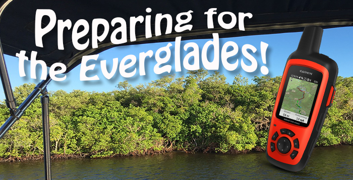
We’re making our way south after our extended stay in Fort Myers towards the Florida Keys.

Our Coverage? App shows we may only get some AT&T signal

The upcoming route will have us cruising through the Everglades, with some reported amazing anchorages along the way. The problem however is that cellular connectivity is likely to be a challenge.

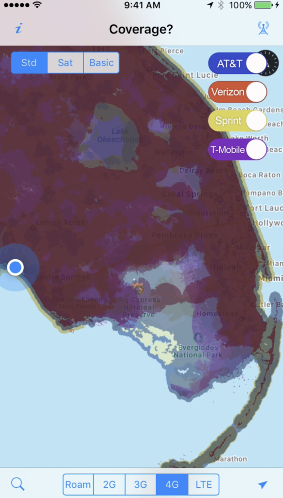
Our app Coverage? shows Verizon, T-Mobile and Sprint have almost no coverage for most of the coastal route, and that we might be able to pick up some AT&T.

We’ve learned long ago to not rely on just one carrier’s reported coverage maps, and we really want to feel like we can stop for a few days and enjoy the area. Taking a few days offline is always a good thing.

But we’re smack dab in the middle of hurricane season. Not having access to weather reports would be dangerous. And some communications with outside world would be preferred – at least to send out an SOS if we need it.

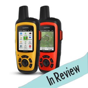
So we decided to purchase the Garmin inReach Explorer+ ($449.99 on Amazon), a consumer accessible option based on the Iridum satellite technology.

We’ve tracked it for a while in the satellite internet section of our Mobile Internet Resource Center, so a perfect opportunity to review it too.

It allows for basic two-way text communication, tracking, weather reports, maps and SOS. We can even post to Facebook and Twitter from it.

It seems like a perfect fit for this next leg of the adventure. The device does require a monthly subscription to access these services – ranging from $12 – 100 per month (we’ve started with the month-to-month Recreation option for $34.95/month).

Here’s a quick video of why we selected this device, and what it does:

We have the device setup to provide 10 minute tracking breadcrumbs to a shared map we’ve given to our family & assistants, and given them the ability to send us messages if needed.  Our loved ones also have our intended travel plans and sail plan information for emergencies.

Our tracking map as started – our MIA members of RVMobileInternet.com can follow along and help us test it.

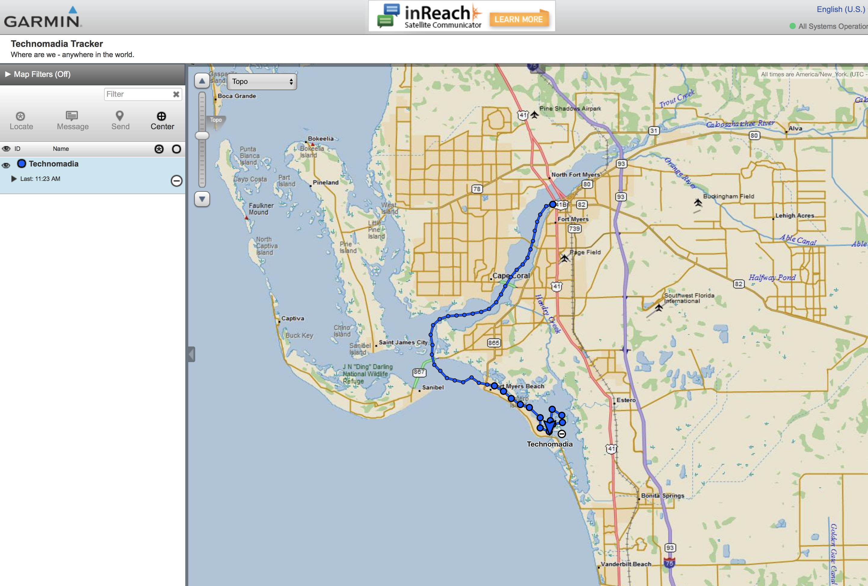
We’ve also shared a link to the map with our MIA members (our premium membership to the Mobile Internet Resource Center). So they’ll be able to help us test it over the coming weeks.

(Are you a member? Check the newsletter we sent out this week for the link, or in the member section of above linked product overview.)

And we’ve set up free text location messages to go out to our Twitter and Facebook page to update our followers during our journey, which you can track if you like.

In a couple days, we should be venturing off grid a bit and exploring the Everglades!  We’re super excited, and we’re of course taking photos & video along the way to share later!

See you in the Keys!

Sharing is Caring:

  • Click to email a link to a friend (Opens in new window) Email
  • Click to share on Facebook (Opens in new window) Facebook
  • Click to share on X (Opens in new window) X
  • Click to share on Pinterest (Opens in new window) Pinterest

Like this:

Like Loading...

Related

Boating Cruising / Boating (March 2017 - present) Gear Mobile Technology Tech Reviews Technology Travel Plans

Reader Interactions

Comments

  1. Linda Kelly says

    Aug 10, 2017 at 11:45 am

    Don’t drop it overboard. A gator will eat it!

    Reply
  2. Anne Stauffer says

    Aug 10, 2017 at 10:35 am

    I’m so pleased you are reviewing the InReach Explorer! I’ve been eyeing it but hesitating due to price. The tracking map is great. Have fun!

    Reply
  3. Jeannine says

    Aug 9, 2017 at 12:05 pm

    Hi Cherie,
    You’re correct with phone coverage. I spent a season as volunteer in Everglades National Park, mostly in Long Pine Key Campground. AT&T is the strongest, and sometimes the only carrier that transmits. Many campers with other carriers found themselves traveling miles around the park to get an adequate signal. My AT&T service did fine; at worst, I had to just get out of the trailer.
    For you and Chris being on the water, the Garmin satellite communicator is a smart device to have.
    Have a great time in the Everglades and the Keys. If you can make it out to Dry Tortugas, don’t forget snorkel gear. It’s an amazing place!

    Reply
  4. Prima Donna says

    Aug 8, 2017 at 6:12 pm

    Just stay safe! 🙂

    Reply

This blog is fueled by YOUR enthusiasm. Your comments help inspire the next post.. don't be shy!Cancel reply

Primary Sidebar

Welcome to Technomadia!

technomadia
Chris Dunphy & Cherie Ve Ard - Technomadia.

Perpetually on the road since 2006 combining technology and travel (tech+nomad). Semi-retired now, working remotely runnng the Mobile Internet Resource Center - helping our nomadic community stay connected.

We currently split our time between our motoryacht slowing doing the Great Loop, our vintage bus in the west and a camper van to move between them.

Mobile Internet – It’s Our Passion!

We track and education on mobile internet options for RVers and cruisers as our 'day job'.

Visit our extensive resource center at: Mobile Internet Resource Center

To see our personal mobile internet setup:
Technomadia's Internet Setup

Our Newest Posts

Annapolis, Baltimore and More – Wrapping Up our 2025 Chesapeake Bay Cruising Adventures!

Nov 13, 2025 By Cherie Ve Ard 2 Comments

Eastern Bay & Chester River – Upper Chesapeake Bay Great Loop Cruising

Oct 25, 2025 By Cherie Ve Ard 1 Comment

Choptank River Adventures – Upper Eastern Chesapeake Bay: Great Loop Cruising

Oct 8, 2025 By Cherie Ve Ard 4 Comments

Anchoring vs Marinas: Which is Better?

Sep 19, 2025 By Cherie Ve Ard 2 Comments

Returning Down the Potomac River and Back to the Chesapeake Bay – Great Loop Side Trip

Sep 5, 2025 By Cherie Ve Ard 3 Comments

Our Resource Centers

  • RVing Resources

    Our informational RVing content.

  • Boating Resources

    Our informational cruising content. 

  • No Excuses: Go Nomadic

    Logistics of a nomadic life: domicile, finances, safety and more. 

  • Mobile Internet Recource Center

    Guides, Reviews & News about Mobile Internet Options for RVers & Boaters (our 'day job')

  • Interviews

    Our 'Ramblings' Series - tales with other nomads. 

  • Solar

    Solar Electrical Systems for RVs

  • Boondocking

    Getting Off Grid and into Wild Camping

  • RV Workspaces

    Full Time RVing Workspaces

Our Travel Apps

We write mobile apps inspired by our own nomadic lifestyle.


Coverage?Coverage? directly overlays and compares cellular carrier data maps. Perfect for bandwidth hungry travelers!
Download_on_the_App_Store_Badge_US-UK_135x40 Get it on Google Play

US Public LandsUS Public Lands overlays BLM, Forest Service, NPS and public land boundary maps. Helping you utilize US national resources!
Download_on_the_App_Store_Badge_US-UK_135x40 Get it on Google Play

StatelinesState Lines tracks over 50 laws that change as you cross US state lines - beer, txt, seat belts, smoking, RVing, etc.
Download_on_the_App_Store_Badge_US-UK_135x40 Get it on Google Play

Footer

Fleet Status & Travel ‘Plans’

Boat: In storage - Maryland
Bus: In storage - Arizona
Van: In motion - MD to FL to AZ

Current Travel Segment:

Back to van life - first Florida, then Arizona for winter! Technomadia

Are we coming your way?

Be In Touch!
View our full Travel Map

Join Us – Be In Touch

Contact Us

YouTube

Facebook

BlueSky

RSS Feed

Subscribe to our Posts 

Archives

About This Website

This is our virtual living room - sharing here is our hobby, not our primary income source. Yup, we do this all for fun. We are self-funded and accept no sponsorships, advertising or guest posts.

Some links however may be affiliate links - they provide a little extra ka-ching to keep us motivated. Some items we may have received at no cost (always disclosed).

Our motivation is to share a slice of our mobile lifestyle and make new friends. Technomadia.com is provided for entertainment purposes only.

This content is copyrighted

We love it when you share our content, but please ask before copying it. Thanks!

Privacy Policy
Terms of Service & Disclosure

  • Mobile Internet
  • Solar
  • Lithium
  • Boondocking
  • Workspaces
  • Interviews
  • Gear
  • No Excuses
  • Videos
 

Loading Comments...
 

    %d